Loading...

Mavic 3 Multispectral

NewDJI

Mavic 3 Multispectral

Five cameras including a 4/3” CMOS Sensor and 4 x 5MP G/R/RE/NIR

Up to 43 minutes of flight time, perfect for longer missions

Advanced safety with Omnidirectional obstacle avoidance, Advanced RTH and APAS 5.0

Support for expansion modules including the M3E RTK Module

DJI O3 Enterprise Transmission providing up to 15 km of HD video transmission

Built in SUnlight Sensor, capturing Solar Irradiance

Social media:

Features

Image

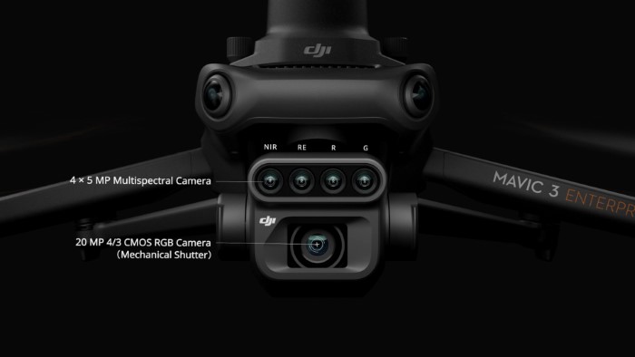
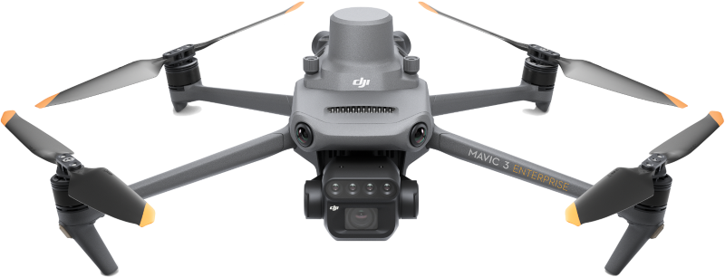
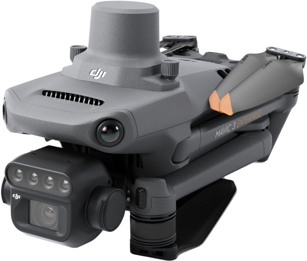
Compact and Powerful

Based on the now iconic design of the industry-leading DJI Mavic 3 drone series, the new DJI Mavic 3 Multispectral packs essential RPAS features into a compact package that’s ready to deploy in seconds. Compact and portable, the DJI M3EM empowers pilots to achieve mission objectives no matter the environment.

Image

Integrated Imaging System

DJI Mavic 3 Multispectral brings users the power of not one, no two, but 5 sensors in it's gimbal. Wide Angle Camera M3E’s primary wide camera features a massive 4/3” CMOS sensor delivering 20MP imaging via a traditional mechanical shutter. Multispectral Camera 5MP in each sensor including Near-infrared (NIR), Red (R), Red Edge (RE) and Green (G).

Image

Sunlight Sensor

The built-in sunlight sensor captures solar irradiance and records it in an image file, allowing for light compensation of image data during 2D reconstruction. This results in more accurate NDVI results, as well as improved accuracy and consistency of data acquired over time.

Image

RTK Module

Combine the DJI Mavic 3M with the RTK module for centimeter-level positioning, giving you accurate images that capture every pixel. Flight control, the camera, and the RTK module sync in microseconds to accurately capture the location of each camera's imaging center. Ultimately, this enables Mavic 3M to do high-precision aerial surveying without using ground control points.

Image

Optimised Performance

Alleviate stress and focus on the task at hand with DJI M3M’s advanced features, designed to make flight safe and easy. Experience up to 43 minutes of cruise time with a single battery and use the DJI M3E Battery Charging Hub for 100W fast charging. Fly safer with the omnidirectional obstactle sensions and terrain-follow features.

Image

Advanced Applications

Mavic 3M allows terrain-follow aerial surveying of orchards, even on sloped landscapes. Together with DJI Terra or DJI SmartFarm Platform to reconstruct high-resolution orchard maps, automatically identify the number of trees, distinguish trees from other obstacles or objects, and generate three-dimensional operation routes for agricultural drones, making operations safer and more efficient.

Image

DJI RC Pro Enterprise

DJI M3E comes with a brand new and improved remote controller experience - the DJI RC Pro Enterprise. An upgraded version of the consumer series DJI RC Pro controller, the RC Pro Enterprise is comfortable in the hand and provides live mission feed and reporting via the built-in ultrabright 5.5” touchscreen.

Image

Mission Ready Software

The Mavic 3M can carry out automatic field scouting. The field scout images can be uploaded to the DJI SmartFarm Platform in real time through a 4G network. It can find abnormalities, such as emergence deficiencies, weed pressure, and crop lodging in a timely manner. It can also conduct intelligent analyses, such as cotton seedling identification and rice production testing, using AI identification for real-time sharing of crop growth information, guidance of agronomic activities, and easy management of 70 hectares of farmland by one person.

Image

Environmental Monitoring

The Mavic 3M can also be used in environment and natural resource surveys, such as water enrichment monitoring, forest distribution surveys, urban green area surveys, and more.


Introducing DJI Mavic 3 Multispectral

The Mavic 3M is a compact drone with five cameras; a 4/3 CMOS 20MP RGB camera and four 5MP multispectral cameras (green, red, red edge, and near-infrared). With its 0.7s mechanical shutter speed and 43-minute flight time, you can confidently complete a 200-hectare mapping mission in a single flight.